


 0
0 1
1 2
2 3
3 4
4 5
5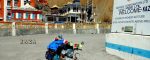 6
6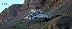 7
7 8
8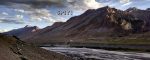 9
9 10
10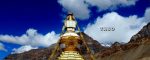 11
11 12
12 13
13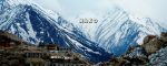 14
14 15
15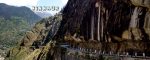 16
16 17
17Route & Day By Day Tour Details | Trip to Spiti & Kinnaur
<<<CLICK HERE TO GO BACK TO EVENT MAIN PAGE>>>
Day By Day Itinerary
Trip Highlights
Mashobara
Mashobra is a small town in Shimla district of Himachal Pradesh. It is home to dense forest and host couple of adventurous and remote jungle resorts.
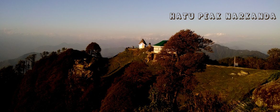
Hatu Peak, Narkanda
Hatu peak is located at an elevation of 3400 m/12000 ft above sea level and is the highest summit in Shimla/Narkanda region of Himachal Pradesh, India. The peak is surrounded by dense woods. The area has forests of fir and spruce, with a smattering of maple, aspen and cedar trees.The peak offers spectacular view of the entire Himalayan ranges.
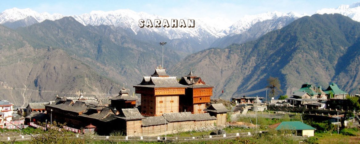
Sarahan
Located halfway up a high mountain side, the road to Sarahan winds past flowering Pine trees that give way to stately Oaks. Dozens of small streams rush past. The fields and orchards that surround the small villages with their slate roofed houses, compose pictures of pastoral perfection. Above Sarahan, a many deodar trees rides the slopes and higher still, encircling the Bashal peak, are trees of smooth birch and variety of wild flowers and rare medicinal herbs. This sparsely populated tract is steeped in ancient legends and here is the famous Bhimakali temple regarded as one of the Fifty One sacred Shaktipeethhs. The temple’s unusual architecture and wealth of carvings have made it a resplendent example of what is loosely called the Indo-Tibetan style. Deep down the alley flows the river Sutlej and across lies the snow-clad Shrikhand peak.
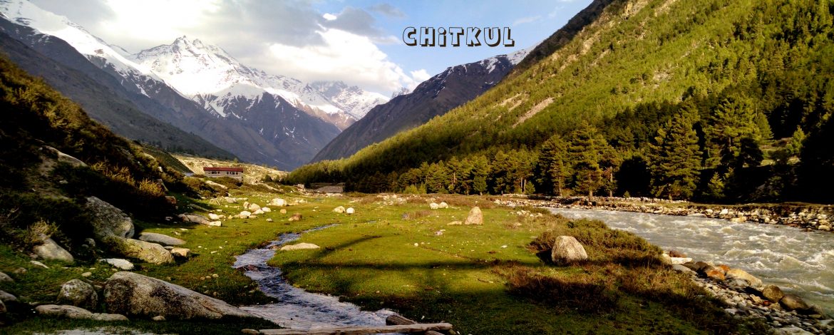
Chitkul
Chitkul is a pictorious and scenic village in Kinnaur district of Himachal Pradesh. It is the last inhabited village near the Indo-China border. The Indian road ends here. Chitkul, on the banks of Baspa River, is the first village of the Baspa Valley and the last village on the old Hindustan-Tibet trade route. It is also the last point in India one can travel to without a permit.Road to reach Chitkul is quiet narrow and had been featured in ‘World’s toughest roads’ series by Discovery channel.
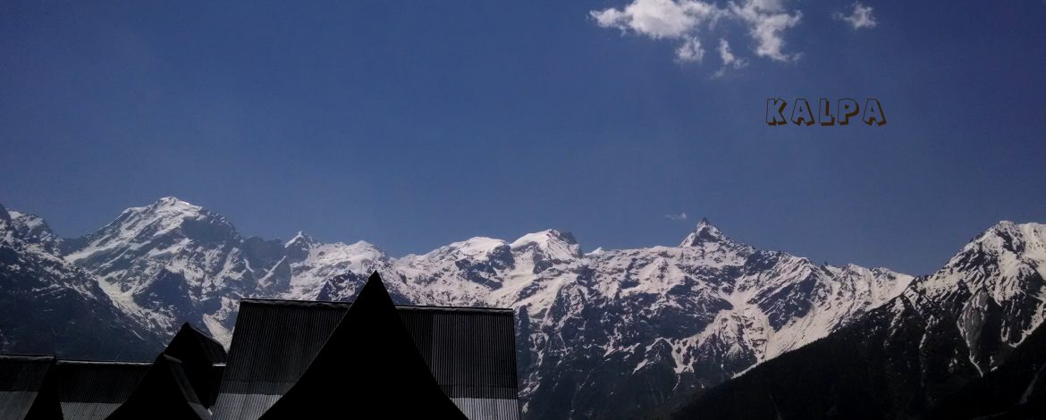
Kalpa
Kalpa is one of the biggest and beautiful villages of Kinnaur. One can enter Kinnaur district at Village Chshora and follow a straight line road constructed in vertical rock and it is a rare treat to travel on this road which is a great engineering feat.Situated at the height of 2758 m above the sea level and 110 km from Sarahan, Kalpa is a beautiful and main village of Kinnaur. Across the river faces the majestic mountains of the Kinner Kailash range. These are spectacular sights early in the morning as the rising sun touches the snowy peaks with crimson and golden light.
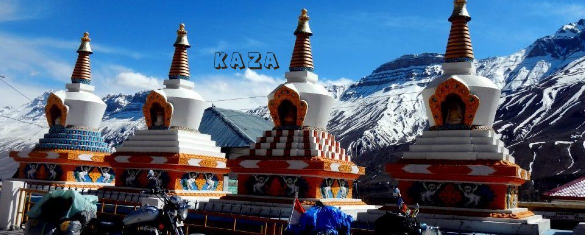
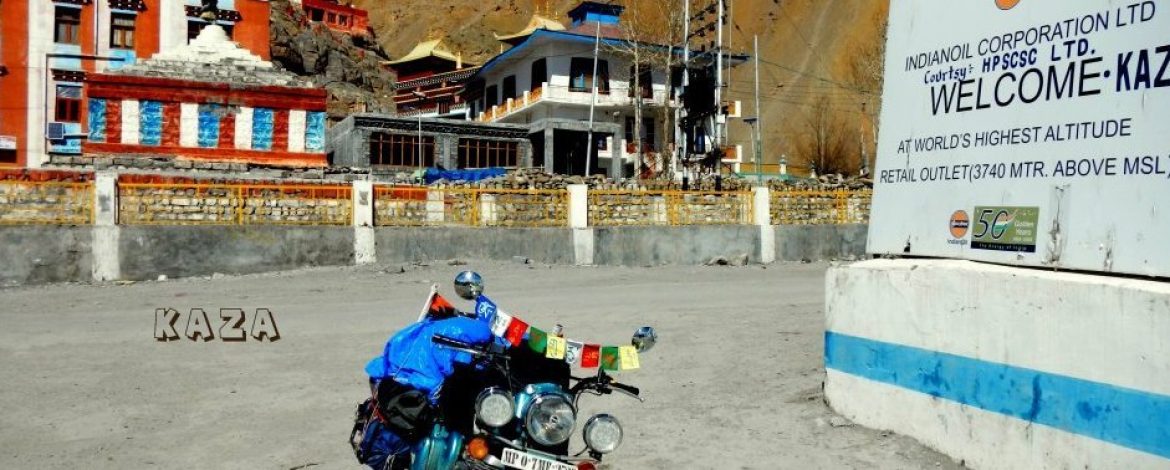
Kaza
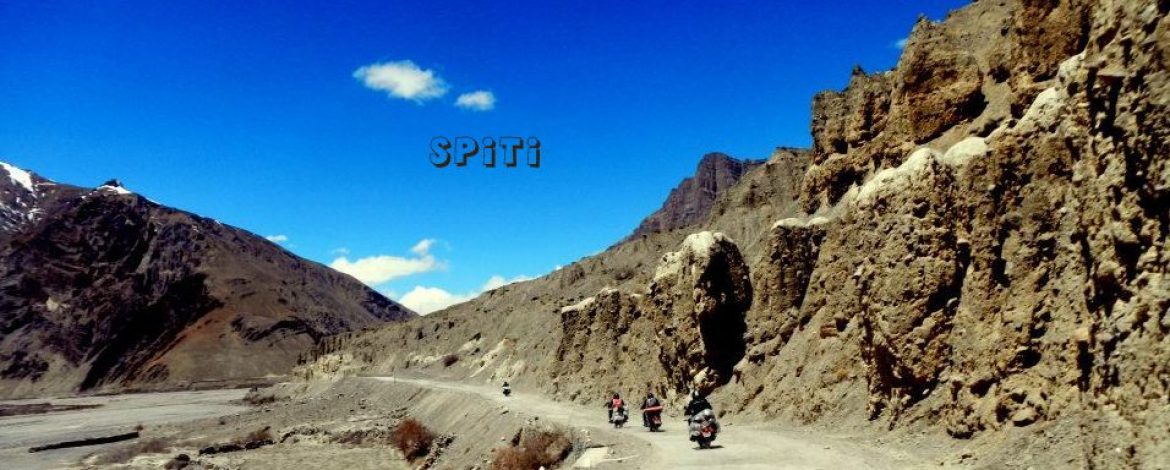
The town of Kaza, Kaze or Kaja is the subdivisional headquarters of the remote Spiti Valley in the Lahaul and Spiti district of the state of Himachal Pradesh in the Western Himalayas of India. Spiti, which is a part of the Lahaul and Spiti district of Himachal, is a high altitude or cold desert having close similarities to the neighbouring Tibet and Ladakh regions in terms of terrain, climate and the Buddhist culture. Kaza, situated along the Spiti River river at an elevation of 3,650 metres (11,980 ft) above mean sea level, is the largest township and commercial center of the valley .
Kye
7 km from Kaza at an elevation of 4116 mtrs. The largest monastery in Spiti Valley. Established in the 11th century has ancient Buddhist scrolls and paintings. It also houses large number of Buddhist monks and nuns. From here one can have the amazing views of complete valley.
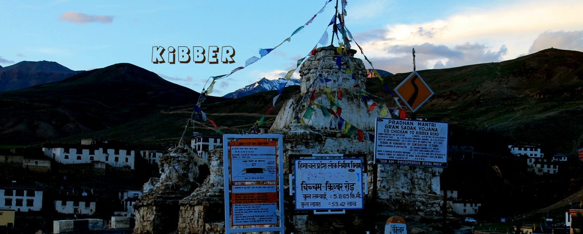
Kibber
Kibber is a village high in the Spiti Valley in the Himalayas at 4270 metres or 14,200 ft. It contains a monastery and the Kibber Wildlife Sanctuary. Kibber lies in a narrow valley on the summit of a limestone rock.18 km from Kaza. The highest village in the world which is connected by motorable road and is the highest habitated village in the world which has its own polling station during elections.
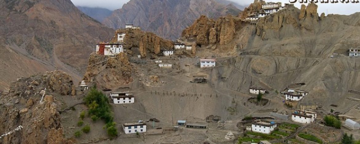
Dhankar Gompa
It is situated at an elevation of 3,894 metres (12,774 feet) in the Spiti Valley above Dhankar Village, between the towns of Kaza and Tabo. The complex is built on a 1000-foot (300-metre) high spur overlooking the confluence of the Spiti and Pin Rivers – one of the world’s most spectacular settings for a gompa. Dhang or dang means cliff, andkar or khar means fort. Hence Dhangkar means fort on a cliff.
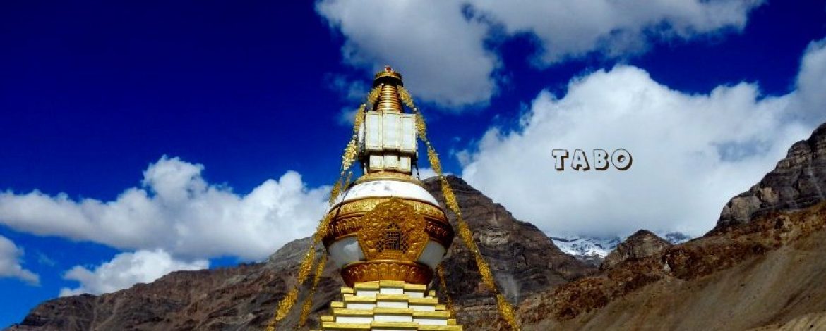
Tabo
At 3050 m and 163 km from Kalpa is the ancient village of Tabo, situated on the left bank of river Spiti. Flanked on either sides by hills, its has one of the most important Buddhist monasteries regarded by many as only next to the Tholing Gompa in Tibet. It is also known as the Ajanta of the Himalayas. Tabo is the largest monastic complex of Spiti which has since been declared a protected monument under the aegis of Archaeological Survey of India.
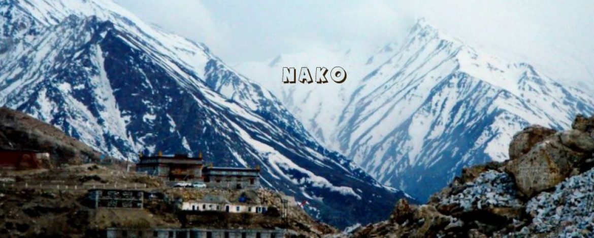
Nako
Nako is a village in the Himalayas of northern India, located near the Indo-China border in the Trans-Himalayan region of Kinnaur district in Himachal Pradesh.Nako Lake is a prominent feature here where it borders the village. Nako Monastery, dated to 1025, is located in the village as well as several other Buddhist chortens.Nako is the largest village at an elevation of 3,625 metres (11,893 ft) (3,662 metres (12,014 ft) is also mentioned) in the Hangrang Valley with the backdrop of Reo Purgyal which has an elevation of 6,816 metres (22,362 ft) and is the highest mountain in Himachal Pradesh.
Gui
Nestled deep within the Trans-Himalayan cold desert of the Spiti Valley in Himachal Pradesh is the tiny village of Gue which is relatively unknown and unheard of in the traveller circuit. The village of Gue is situated at an altitude or around 10,499 feet above sea-level and is only a few kilometres away from the Indo-China border. Gue also houses India’s only known naturally preserved mummy.